


Dutch Utrecht Polder path
Discover the beauty of the open moorland area
Walk through the open polders, on the border of South Holland and Utrecht, along ancient country lanes and historically important watercourses. The production of cheese and other dairy products has traditionally been the connecting factor in this area. It is a true Cheese Valley. This is reflected in the various cheese museums, cheese warehouses, cheese markets and shops offering the most delicious regional products.
The walk goes right through the peat meadow area of the Green Heart. Walking along the centuries-old country roads and historically important watercourses, you will experience the salutary peace and space of the Green Heart.
Walking along watercourses
The Steinse Tiendweg is an old trade ro...
Discover the beauty of the open moorland area
Walk through the open polders, on the border of South Holland and Utrecht, along ancient country lanes and historically important watercourses. The production of cheese and other dairy products has traditionally been the connecting factor in this area. It is a true Cheese Valley. This is reflected in the various cheese museums, cheese warehouses, cheese markets and shops offering the most delicious regional products.
The walk goes right through the peat meadow area of the Green Heart. Walking along the centuries-old country roads and historically important watercourses, you will experience the salutary peace and space of the Green Heart.
Walking along watercourses
The Steinse Tiendweg is an old trade route dating back to the 14th century. A wetering, a wide ditch, was dug between the Enkele Wiericke and the Hollandse IJssel between 1330 and 1370. The Tiendweg follows the route of this wetering. Along both sides of the Tiendweg, the waterways can still be seen. The route also passes the Double Wiericke, which was dug around 1360. This canal runs between the Oude Rijn and the Hollandse IJssel.
Old Dutch Waterline
Water was an important part of the infrastructure, but also an ally in times of war. In 1672, our country was invaded by armies from France, England and some German states. Holland was defended by flooding land along its borders. This included the land between the Enkele and Dubbele Wiericke, the polder Lange Weide. This was the narrowest part of the Old Dutch Waterline
Westeindse Kade and Ruigeweidse Achterkade
The walking route then goes along the Ruigeweidse Achterkade, which actually consists of two quays. The Westeindse Kade on the north side and the Ruige Weidse Achterkade on the south side. The construction of the kaden dates back to the 12th century, the time when this swampy area was reclaimed. Over the years, the so-called parting ditch between the two kaden has grown closed and dried up to only the slight 'dent' that can be seen today. Since the kaden form the border between the provinces of South Holland and Utrecht, you could easily jump from one province to the other.
Reclamation in the Middle Ages
The Dutch-Utrecht peat meadow area was reclaimed in the Middle Ages according to a cope. This was an agreement between the count of Holland or the bishop of Utrecht and the landowner. This included that the reclamation was allowed to reclaim up to 1250 metres deep and 113 metres wide marshland, by digging ditches. Most of today's pastures still have this size. The name of the nearby town of Papekop is an amalgamation of papen and cope, where papen refers to the owners of the cope: the church authority in Utrecht. Papen is a spot name for Catholics, so the naming seems to be the Dutch name for a Utrecht town.
Colophon: Text: Landschapsbeheer Zuid-Holland i.c.w. VANL Lange Ruige Weide and Staatsbosbeheer.
You are going to see this
-
-
-
-
-
70
-
41
-
28
-
53
-
91
-
90
-
98
-
-
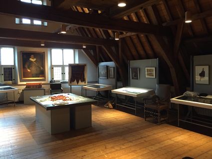
Museum Paulina Bisdom van Vliet
Museum Paulina Bisdom van Vliet
Hoogstraat 164–166
2851 BE Haastrecht
-
-
-
-
-
-
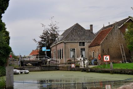
Innudation area Old Dutch Waterline Hekendorp
Innudation area Old Dutch Waterline Hekendorp
Hekendorp
-
99
-
47
-
75
-
18
-
49
-
83
-
36
-
96
-
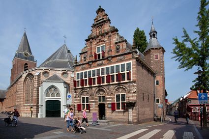
Nationaal Museum de Heksenwaag
Nationaal Museum de Heksenwaag
Leeuweringerstraat 2
3421 AC Oudewater
-
-
-
-
Tourist Information Point Oudewater
Tourist Information Point Oudewater
TIP Oud
Leeuweringerstraat 10
3421 AC Oudewater
-
30
-
54
-
15
-
41
-
87
-
-
-
-
-
-
-
-
-








Description
Public transport
The walking route starts and ends at a train station. It is therefore easy to get to the starting point by public transport and also to return home by public transport.
From Station Gouda Goverwelle, you walk via the Muziekpad to the Goverwellesingel. This is where the walking network starts.
From Woerden station, pick up the route from the centre side of the station. Then walk the node numbers in reverse order to Gouda Goverwelle station.
Parking
Would you rather travel by car? Parking is available around Gouda Goverwelle station or around Woerden station / car parks in and around the centre of Woerden (paid). Parking is also available in neighbouring villages such as Haastrecht, Hekendorp, Driebruggen, Waarder and Papekop if you wish to pick up the route at another point.
Boarding the route
During the route, buses can be boarded from Haastrecht, Hekendorp and Oudewater towards Utrecht or Gouda. For the most up-to-date arrival and departure times, check 9292.nl. Use the map or the GPX to walk to the route to pick it up.
Signposting
This route follows the walking junction network, recognisable by the orange shields with blue numbers and arrows (province of Utrecht) or yellow shields with red numbers and arrows (Zuid-Holland). An overview of all nodes can be found under the Nodes tab.
For the road
- The route follows unpaved paths and is therefore not suitable for wheelchairs and prams.
- Dogs are not allowed.
- Please only walk on the designated paths to protect and not disturb flora and fauna.
- Some locations and trails are on private property, please take this into account.
- Please take rubbish back home, this is how we keep the area clean and attractive.
- 70
- 41
- 28
- 53
- 91
- 90
- 98
- 99
- 47
- 75
- 18
- 49
- 83
- 36
- 96
- 30
- 54
- 15
- 41
- 87